The two hour drive heading south to Dovrevegen was mostly uneventful. Only one or two vistas of any interest, but there was nowhere to pull over. I chose the Kongvoll lodge area because the musk ox trail starts right across the street. When I read about the potential to see musk ox, I could not resist trying. The closest anything else is thirty minutes away, so I chose to go for just one night. The weather reports had gone back and forth between rain and not rain, but eventually settled on a small chance of rain.
The trail begins at a nearby defunct train station and begins a slow ascent up the mountain.
 |
| I encountered this dead rodent(shrew?) on the way up. |
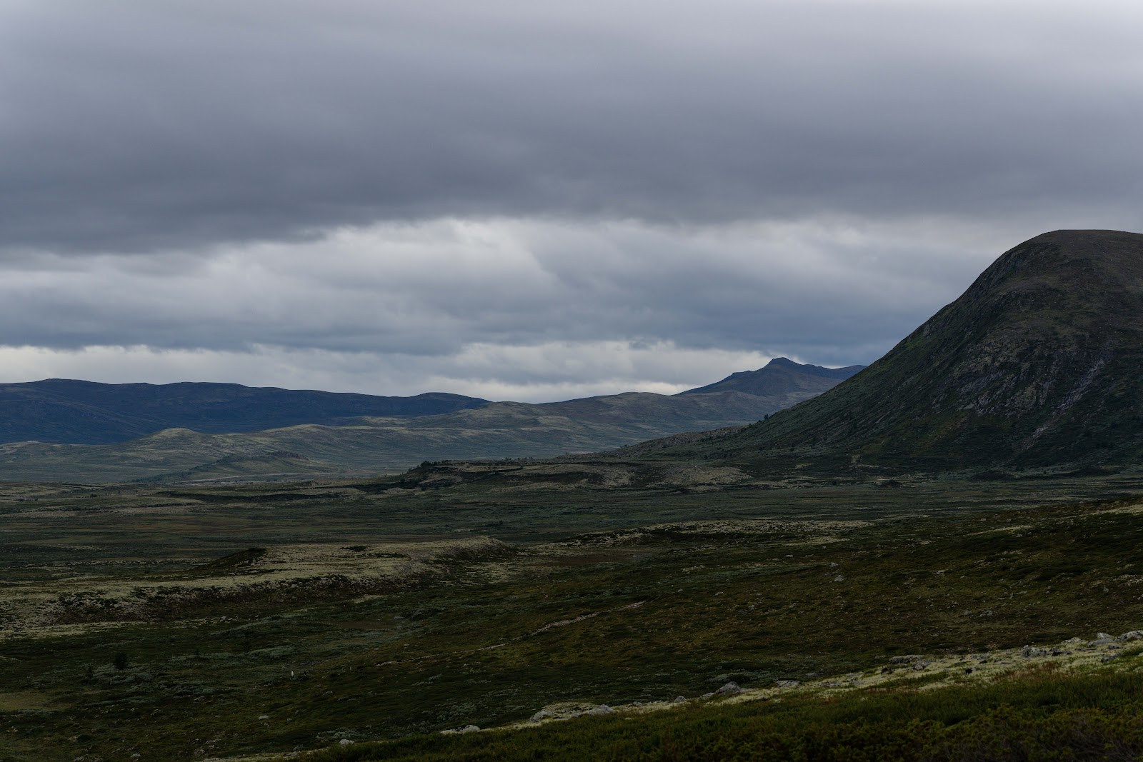
Once on top, I continued on the path to the right, which continued upward toward a beautiful area with great views on all sides. Unfortunately, it began to rain lightly, so I put my rain jacket over my short sleeved shirt, protecting my cameras underneath. I continued a bit past the hiking trail, trying to spot any musk ox and also taking pictures from different perspectives. I put my cameras away at this point and went back toward the trail.


 |
| I took a phone picture of this rock, because I don't recall seeing many rocks like this on my travels. |


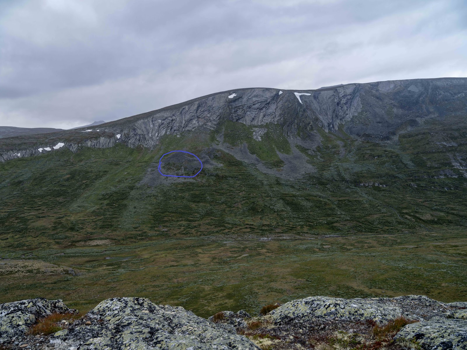
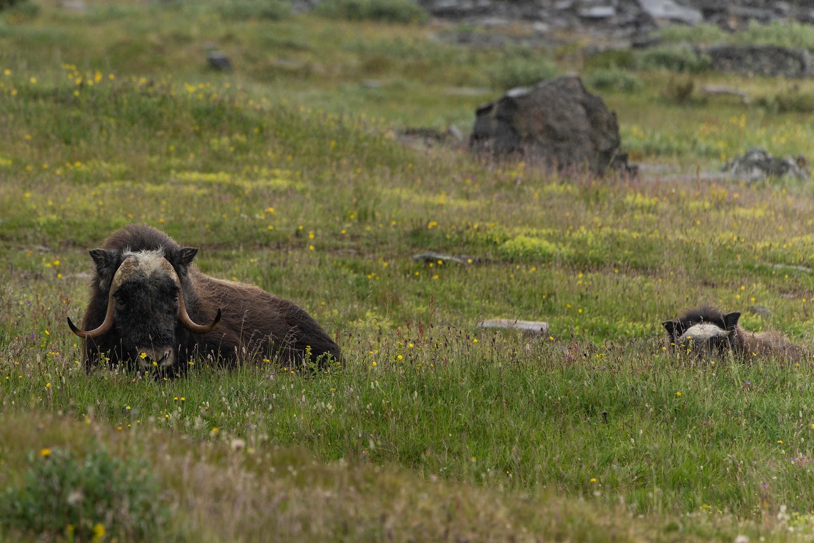
I honestly wasn't even sure if I was in the right area, because cell phone pics using the 10x zoom was not showing me anything definitively, and while looking up the mountain, the angle didn't reveal anything to me. Once I got close enough, I used my camera zoom to locate some antlers, and I felt great relief. I got as close as I felt comfortable being, and then laid down in the grass to take pictures.


Following the gps with my download hiking map, I made my way down the mountain. I took one small tumble, and gave myself a small gash below my right eye. I felt it happen, but I couldn't see anything with my camera phone in selfie mode at the time. I took what I thought was a shortcut. Unfortunately the arrow that my gps was showing, was inaccurate. I couldn't recalibrate it, and continued on a path on the ground that I thought was leading in the right direction. I encountered a man with two children. Once they had past me bit a little bit, I decided to double check my directions with them. They were headed where I was supposed to be headed, so I quickly changed course and joined them, retracing my route a bit before correcting.
By this time, the sun was beginning to come out, and I took out my camera again. I took pictures on the way down.


The total hike clocked in at just over four hours, perhaps making it the third longest hike in my life, after Yakushima, Japan and Zagori mountains, Greece.
 |
| This is the front view of my hotel, the only complex in the area. |
Below is the view of the hiking map, with red being the Alltrails hike and the blue being a rough approximation of my modifications.

No comments:
Post a Comment