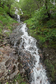
On our final day in Scotland, we decided to go on one last hike, before driving to the airport hotel. Steall Falls, said to be the second largest waterfall in Scotland, was about a 25 minute drive from Fort William. I had read that the hike took between 1.5-2 hours in total, walking to the waterfall and back.
A twisty one lane road took us to the parking lot. The weather was cloudy, with occasional drizzling. The path was nice. It was rocky and took us through many smaller waterfalls.
In less than forty minutes, the path opened up into a field. Miles, despite complaining when we began, was actually disappointed in how short the walk was. We got lucky, and the sun came out for a bit, and we had only a few seconds of drizzle.
Nearby was a rope bridge, allowing us to follow a path that led us right up to the falls. Miles was unable to reach both sides of the top ropes, so held on to just one side. He was incredibly brave, as the height of course bothered me.
We crossed the boggy ground and climbed some rocks in order to be just underneath.
We returned to our hotel, collected our belongings, and began the two and a half hour trip to our airport hotel. Despite looking a bit rundown on the outside, the Holiday Inn Express was beautiful inside. We hooked up the laptop to the tv and finished watching Robin Hood: Men in Tights. Then, we watched a netflix show that discussed Monty Python sketches, through the eyes of different comedians, such as Jim Carry and Mike Myers.
Some final thoughts:
I had anticipated Skye as being the highlight of the trip. Instead, I found Glencoe to be the most beautiful region, with its majestic mountains. I wish I had had more time to explore it. Kerrerra and Lismore were my favorite days and hikes. I am glad that the boat tours allowed Miles to see some exotic animals. I enjoyed the first one much more than the second, which I didn't feel offered much other than the luck of seeing Dolphins up close.
The one lane roads are tiresome and jarring with their windiness and necessity of making sudden stops when encountering other drivers. I disliked how there were never mirrors to help alleviate the windy roads or blind summits. I greatly disliked the lack of toilet facilities throughout our trip, with Skye being the worst offender.
The owner of the bed and breakfast in Skye had told us not to worry when walking around Scotland, because there are no trespassing laws in Scotland. Upon returning home, I googled this, and this appears to be incorrect. It must be a myth that gets passed around.
Tuesday, June 19, 2018
Saturday, June 16, 2018
Scotland 2.9: A missed day, Neist Lighthouse, some castle ruins, and the tracks of Potter.
Two days ago I had a lot of health problems. To make matters worse, it was rainy outside, with very heavy winds. Outside of a short trip to the grocery store, we stayed inside all day. The bed and breakfast had a few stacks of dvds, for guests to share. The two of them enjoyed watching a series on wildlife on the Scottish Islands, and then Miles watched Shaun the Sheep and some other movie with Will Ferrell. At night, we hooked up the computer to the tv and watched Monty Python And the Holy Grail. Miles loved it.
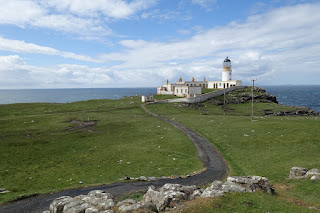
The next day was not as windy, and my problems were not as bad. We ventured out to the western part of Skye, to visit the Neist Point Lighthouse. It was about an hour drive away, and when we were just minutes away, it was pouring. I parked the car and it was still raining. I was hesitant to go out, but pushed myself.
First, Stephanie and I needed to use the bathroom. About two minutes away from the parking lot is a gift shop with bathrooms. They had a sign outside saying they were closed, right next to the sign saying that they are open all year round. Scotland doesn't seem to believe in installing toilets near their natural attractions. Further evidence of the need for toilets became clear when we found a rock that provided a hiding spot, and it was littered with toilet paper and even tampons.
The sun miraculously came out, and we began our descent towards the Neist Point Lighthouse
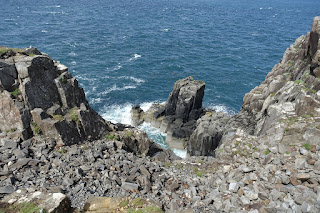
We spent some time enjoying the view of the ocean and the magnificent rocks that were on the far side of the lighthouse. About halfway through our walk back to the car, the clouds quickly reappeared and it started to drizzle, and then rain heavily. As we drove away, the gift shop was reopened.
We drove to Portree, the biggest town in Skye, ate some lunch, and browsed some of the shops. I was not impressed. We had dinner at our favorite local spot in Uig, the Uig Hotel. Back at the bed and breakfast, we watched the first two thirds of Robin Hood: Men in Tights. Miles liked it.
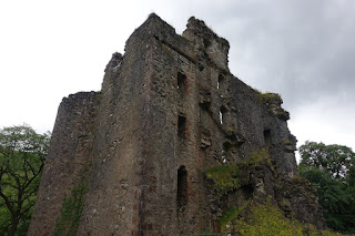
Today began our two day journey back to Glasgow Airport. Our final stop today would be in Fort William. We stopped for a five minute gander at the ruins of Invergarry Castle. It was completely enclosed by a gate with barbed wire, but we were able to view the castle from the sides.
Next, we took a brief stop at Glenfinnan. This area has a viewpoint that overlooks the Glenfinnan Viaduct, where a steam train still operates. This train was featured in the Harry Potter movies. I was disappointed to see that they charged money for parking, something that I have yet to see in Scotland. Additionally, they were selling Harry Potter merchandise in the cafe shop, which I find to be tacky.
It was drizzling, so we put on our waterproof clothes and walked up a very short path to the lookout. The viaduct didn't happen to have the train on it at the time, of course, and so the view was just unexceptional. The exceptional view happened to be in the opposite direction.
We arrived at our first hotel of the trip, which is at the beginning of a pedestrian only street lined with shops. We ate dinner at the local pub and I had an excellent bean quesadilla. Next, we decided to take a forty minute walk to the last castle ruins of our trip, Old Inverlochy Castle.
Thursday, June 14, 2018
Scotland 2.8: A day off, the Quiraing hike, and The Storr- a three day update
The next day we didn't leave until around 3 PM. We spent the morning resting. We drove up to the remains of Strome Castle, another set of castle ruins.
Nearby was a weaver shop. It was on our list of places to visit, but I was surprised at how many signs there were, leading from the main road.
It was a fairly extensive shop. They had all forms of tartan and kilts. There was a very beautiful bag that went alongside a kilt in the full Scottish garb. I ended up not getting it, because it was all leather and I try not to support that. The kilts started at around 450 pounds. Stephanie bought a small book.
Next was the Attadale Gardens. As we walked in, the main entry ticket booth was closed, with a sign saying to pay the gardener if we saw them. The area wasn't super impressive. We made our way in a circle, around the area, not going beyond the house we found. We spotted our first black highland cow.
We were almost back to the car when a woman approached us. She said she was the daughter of the owner. She led us back to the ticket booth, collected payment, and gave detailed description of the layout. There was an area beyond the house, including a "DIY" tearoom, which had sandwiches, drinks, and other snacks, with an honesty system. She showed us a picture from a magazine with herself, along with Prince Charles. I asked her about the black highland cow and she claimed that all highland cows used to be black and they've since changed.
Once she left, we explored the areas that we had missed. There was a small Japanese garden section, but it was unimpressive to me.
Just up the road was a restaurant where I had an excellent mushroom soup and a vegetable black bean casserole, which ended up also being a soup.
We left the next morning for our accommodation in the Trotternish peninsula of Skye, in the northeastern region. The place that we had stayed, during the previous three nights, was an odd place, with an odd vibe. The people were not particularly welcoming and just seemed off. The room was the biggest we had had, at least. Still, I couldn't wait to get out of there.
We hit a bit of a traffic jam, not far into our journey. They were repaving the main road. We must have missed it a few days back, on our way to the fairy pools, by going later in the day. We dropped off our luggage at our new bed and breakfast. It was very hard to find a place on Skye that had rooms for 3 people, even though I had booked in January. I was able to find a place in the biggest town on Skye, Portree, but only for 2 people. This place was a bit off the beaten path, down a farmy side road near the town of Uig.
The place got rave reviews, but I was still a bit worried, due to how remote this side road looked. Luckily, my worries were meritless. The woman running the bed and breakfast was extremely warm. We were shown to our room, which was far and away the biggest room of the trip. The breakfast menu had more options than anywhere else on the trip as well. She even offered to do a load of laundry for us, without charge.
This day was reported to be our last day without ran for the trip, so we left to tackle the bigger of the two hikes on Skye, called the Quiraing. This is one of the biggest attractions in the area, and starts along a tiny single laned road through a mountainous area. The parking lot was small in comparison to the amount of people interested, and so cars were lined up along the road leading to the lot. We found a spot just near the main parking area.
The hike was a loop. We decided to start on the lower side of the mountain, rather than climbing straight to the top and then coming down from the back and walking around. I wasn't sure what to expect, in terms of height and terrain, but the first half of the hike was fairly tame for me. It was also beautiful.
One of the higher rocks had a path leading to the top, but neither me nor Miles had interest in that climb. Halfway through the route, the path leads to a cliff side, and turns towards the top. The path led close to the edge, but away from the edge was a whole field that you could walk up on, following alongside the path. I stayed well away from the cliff side, because I began experiencing overwhelming fear.
It went up and up, but I only approached the edge for pictures once or twice. Stephanie, on the other hand, had no problem walking along the path, and so was able to see everything. She caught sight of a beautiful platform area, where you apparently can also climb up to, from below, that we had missed. People used to hide their herds there, deep in the past. Her pictures are not included here.
On the way to our next destination, we stopped at a waterfall and rock lookout, Kilt Rock and Mealt Falls. I did not find it worthy of posting a picture of. The highlight of this, however, was a small food truck, that sold drinks, along with a lentil soup. The soup was incredible!
Another small walk I wanted to hit before the upcoming rain, was a trip out to Brother's Point, at the edge of a beach. I had trouble finding this on google, so I printed out directions. After we parked our car, I noticed a couple, across the road, walking through someone's gate. I asked them if they were headed to Brother's Point. They answered in the affirmative, and I told them that the entrance was a bit south of here, and that they could follow us there.
We followed the directions that I had printed up, and we were led past a cottage, and then to a path down the hillside, onto a beach.
I had noticed people on a peak, in the distance. We walked in that direction. Upon this beach, as we later found out, are dinosaur footprint fossils. There are many of these on beaches throughout this area of Skye, however, most are only seen under specific tide conditions, with some only able to be seen during the winter when sand is pulled away from the prints, after a storm.
After scurrying up a hillside, overlooking the beach, we arrived at the peak we had seen, named Brother's Point. At this point, I was a bit burnt out on heights, after our last hike, so only Stephanie went across, and stood at the top alongside quite a few very brave sheep. It was still a splendid sight.
We ate dinner at a local hotel that was recommended by our bed and breakfast, as there were only two places in town to eat. She had made reservations for us. The food was excellent.
The next morning we indeed woke up to light rain, wind, and cold. We departed for the other big sight to see on Skye, the Storr hike. The Old Man of Storr is a set of rocks that can be seen from the southeastern side of the Trotternish Peninsula. The parking lot was tiny, so most of the road was covered with cars, on both sides.
At this point, it was not quite raining yet. We still decided to put on waterproof pants over our clothes, along with waterproof jackets. I wore four lighter layers. Half of the hike was uphill, with the second half retracing the steps we had taken on the way up, back down. It began raining as we started upwards. I began sweating and having to take off layers, from exertion, however no combination was particularly comfortable. I ended up in a short sleeve shirt, using the rain jacket as a cape.
I didn't particularly enjoy this hike. There was nothing to see on either side of us, as it was forest that had been cut down. It was only stumps and wreckage. So, the only view was what we saw in front of us, The Storr rocks, fog, clouds, and mist.
At the top, the rain picked up, and the wind was incredible. It was also freezing. I put all four layers back on, and I was thrilled to have brought them. I wore them all the way down. I realized that the wind had been at our back the whole way up, and so the whole way down it would blow directly into us. There were no good pictures to be taken, due to the heavy fog. Stephanie went a little further up, onto a higher rock that people were gathered upon. It was too slick for me to feel comfortable going up with Miles.
We tried to stop briefly at the Lealt Waterfall, but construction on the spot was underway, and everything was closed off. We were uncomfortable from the wetness, and so went home to change clothes.
Our reservations for the same restaurant as the night before, was for 6. We were not hungry, so walked in and rescheduled for 8. Just a few minutes away, was another spot we wanted to visit, what is known as the Fairy Glen. This area has unusual hill formations and a lot of green. With the wind and the rain, it was hard to appreciate, but we did our best. When I was picking out pictures for the blog, I noticed that at this point, I got a smudge on the lens for this portion.
On the way down, Miles slipped and got mud on his leg. We had him sit in the car. on one of the waterproof jackets, and we went home to have him shower and change. When he was done, it was time for dinner. I ended up getting a celery and leak soup, along with a children's meal that Miles had had the previous day. It was really, really good.
Nearby was a weaver shop. It was on our list of places to visit, but I was surprised at how many signs there were, leading from the main road.
It was a fairly extensive shop. They had all forms of tartan and kilts. There was a very beautiful bag that went alongside a kilt in the full Scottish garb. I ended up not getting it, because it was all leather and I try not to support that. The kilts started at around 450 pounds. Stephanie bought a small book.
Next was the Attadale Gardens. As we walked in, the main entry ticket booth was closed, with a sign saying to pay the gardener if we saw them. The area wasn't super impressive. We made our way in a circle, around the area, not going beyond the house we found. We spotted our first black highland cow.
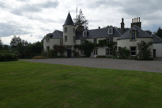
We were almost back to the car when a woman approached us. She said she was the daughter of the owner. She led us back to the ticket booth, collected payment, and gave detailed description of the layout. There was an area beyond the house, including a "DIY" tearoom, which had sandwiches, drinks, and other snacks, with an honesty system. She showed us a picture from a magazine with herself, along with Prince Charles. I asked her about the black highland cow and she claimed that all highland cows used to be black and they've since changed.
Once she left, we explored the areas that we had missed. There was a small Japanese garden section, but it was unimpressive to me.
Just up the road was a restaurant where I had an excellent mushroom soup and a vegetable black bean casserole, which ended up also being a soup.
We left the next morning for our accommodation in the Trotternish peninsula of Skye, in the northeastern region. The place that we had stayed, during the previous three nights, was an odd place, with an odd vibe. The people were not particularly welcoming and just seemed off. The room was the biggest we had had, at least. Still, I couldn't wait to get out of there.
We hit a bit of a traffic jam, not far into our journey. They were repaving the main road. We must have missed it a few days back, on our way to the fairy pools, by going later in the day. We dropped off our luggage at our new bed and breakfast. It was very hard to find a place on Skye that had rooms for 3 people, even though I had booked in January. I was able to find a place in the biggest town on Skye, Portree, but only for 2 people. This place was a bit off the beaten path, down a farmy side road near the town of Uig.
The place got rave reviews, but I was still a bit worried, due to how remote this side road looked. Luckily, my worries were meritless. The woman running the bed and breakfast was extremely warm. We were shown to our room, which was far and away the biggest room of the trip. The breakfast menu had more options than anywhere else on the trip as well. She even offered to do a load of laundry for us, without charge.
This day was reported to be our last day without ran for the trip, so we left to tackle the bigger of the two hikes on Skye, called the Quiraing. This is one of the biggest attractions in the area, and starts along a tiny single laned road through a mountainous area. The parking lot was small in comparison to the amount of people interested, and so cars were lined up along the road leading to the lot. We found a spot just near the main parking area.
The hike was a loop. We decided to start on the lower side of the mountain, rather than climbing straight to the top and then coming down from the back and walking around. I wasn't sure what to expect, in terms of height and terrain, but the first half of the hike was fairly tame for me. It was also beautiful.
One of the higher rocks had a path leading to the top, but neither me nor Miles had interest in that climb. Halfway through the route, the path leads to a cliff side, and turns towards the top. The path led close to the edge, but away from the edge was a whole field that you could walk up on, following alongside the path. I stayed well away from the cliff side, because I began experiencing overwhelming fear.
It went up and up, but I only approached the edge for pictures once or twice. Stephanie, on the other hand, had no problem walking along the path, and so was able to see everything. She caught sight of a beautiful platform area, where you apparently can also climb up to, from below, that we had missed. People used to hide their herds there, deep in the past. Her pictures are not included here.
Coming down from the top, you could see that we were well away from the edge. |
This was the view coming down the mountain, looking just above the car park. |
Another small walk I wanted to hit before the upcoming rain, was a trip out to Brother's Point, at the edge of a beach. I had trouble finding this on google, so I printed out directions. After we parked our car, I noticed a couple, across the road, walking through someone's gate. I asked them if they were headed to Brother's Point. They answered in the affirmative, and I told them that the entrance was a bit south of here, and that they could follow us there.
We followed the directions that I had printed up, and we were led past a cottage, and then to a path down the hillside, onto a beach.
I had noticed people on a peak, in the distance. We walked in that direction. Upon this beach, as we later found out, are dinosaur footprint fossils. There are many of these on beaches throughout this area of Skye, however, most are only seen under specific tide conditions, with some only able to be seen during the winter when sand is pulled away from the prints, after a storm.
After scurrying up a hillside, overlooking the beach, we arrived at the peak we had seen, named Brother's Point. At this point, I was a bit burnt out on heights, after our last hike, so only Stephanie went across, and stood at the top alongside quite a few very brave sheep. It was still a splendid sight.
We ate dinner at a local hotel that was recommended by our bed and breakfast, as there were only two places in town to eat. She had made reservations for us. The food was excellent.
The next morning we indeed woke up to light rain, wind, and cold. We departed for the other big sight to see on Skye, the Storr hike. The Old Man of Storr is a set of rocks that can be seen from the southeastern side of the Trotternish Peninsula. The parking lot was tiny, so most of the road was covered with cars, on both sides.
At this point, it was not quite raining yet. We still decided to put on waterproof pants over our clothes, along with waterproof jackets. I wore four lighter layers. Half of the hike was uphill, with the second half retracing the steps we had taken on the way up, back down. It began raining as we started upwards. I began sweating and having to take off layers, from exertion, however no combination was particularly comfortable. I ended up in a short sleeve shirt, using the rain jacket as a cape.
I didn't particularly enjoy this hike. There was nothing to see on either side of us, as it was forest that had been cut down. It was only stumps and wreckage. So, the only view was what we saw in front of us, The Storr rocks, fog, clouds, and mist.
The big rock is Storr. |
At the top, the rain picked up, and the wind was incredible. It was also freezing. I put all four layers back on, and I was thrilled to have brought them. I wore them all the way down. I realized that the wind had been at our back the whole way up, and so the whole way down it would blow directly into us. There were no good pictures to be taken, due to the heavy fog. Stephanie went a little further up, onto a higher rock that people were gathered upon. It was too slick for me to feel comfortable going up with Miles.
We tried to stop briefly at the Lealt Waterfall, but construction on the spot was underway, and everything was closed off. We were uncomfortable from the wetness, and so went home to change clothes.
Our reservations for the same restaurant as the night before, was for 6. We were not hungry, so walked in and rescheduled for 8. Just a few minutes away, was another spot we wanted to visit, what is known as the Fairy Glen. This area has unusual hill formations and a lot of green. With the wind and the rain, it was hard to appreciate, but we did our best. When I was picking out pictures for the blog, I noticed that at this point, I got a smudge on the lens for this portion.
On the way down, Miles slipped and got mud on his leg. We had him sit in the car. on one of the waterproof jackets, and we went home to have him shower and change. When he was done, it was time for dinner. I ended up getting a celery and leak soup, along with a children's meal that Miles had had the previous day. It was really, really good.
Subscribe to:
Posts (Atom)